Mendocino County Lightning Fires 2008
Below are maps of the
- Orr-Series (Montgomery Woods)
- Horse (Daugherty Creek)
- Jack Smith (Singley/Greenfield) fires.
Maps are presented with the most recent first for each fire.
Click on a map for a larger version.
See e-mail updates
for more more information about the Orr-Series (Montgomery Woods) fire.
See photo page
for pictures of the fire and firefighting.
Many thanks to the hard-working members of Cal Fire and other fire departments
that have come up here. Everyone (crew chiefs, crew members, dozer operators)
has worked hard and done exhausting and dangerous duty
as well as being consistently friendly and helpful.
They have treated our place as though it was theirs, and have always sought
to protect the residents and their homes. Thanks to all!
Below are maps of the fires near our place.
I also have other maps from CDF, including the following fires
(all part of the Mendocino Lightning Complex).
Jameson; Brushy 3 and 4; Red Mountain 1, 2, and 3; Hardy; Huckleberry;
Hardy Creek; Bear Pen; Middle; Burger Creek; Mallo; Cowshed 1, 2, and 3;
Cliff; Cliff Ridge; Sugarloaf; Jacks; Indian.
Email me at rmarch@glenmaple.com
if you would like me to scan any of them for you.
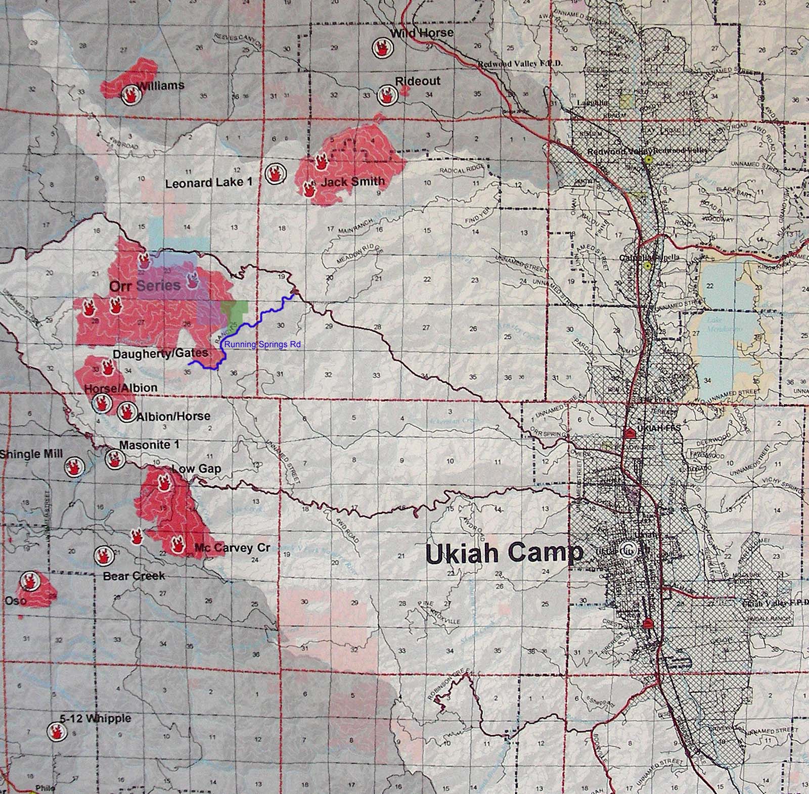
Fires to the West of Ukiah
This 7/11/2008 map shows the fires around Ukiah (all borders are approximate).
Click on the images to see a larger version.
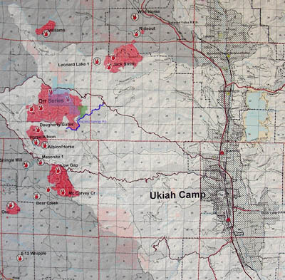
7/11/2008 fires West of Ukiah.
The ones that have a symbol of a flame with a circle around it are contained,
and the ones where the flame has no circle are un-contained.
Montgomery Woods is shaded in blue. Running Springs Ranch Rd is the blue line,
and our place is shaded in green.
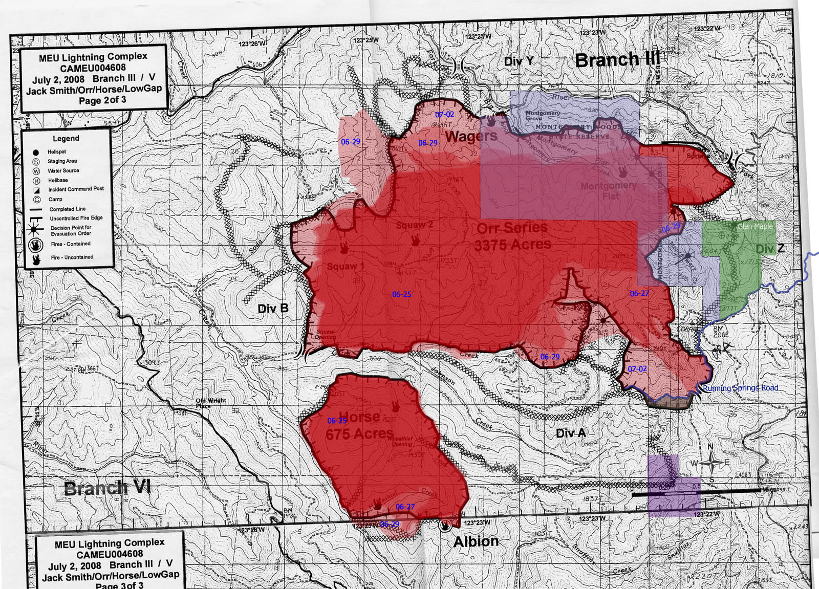
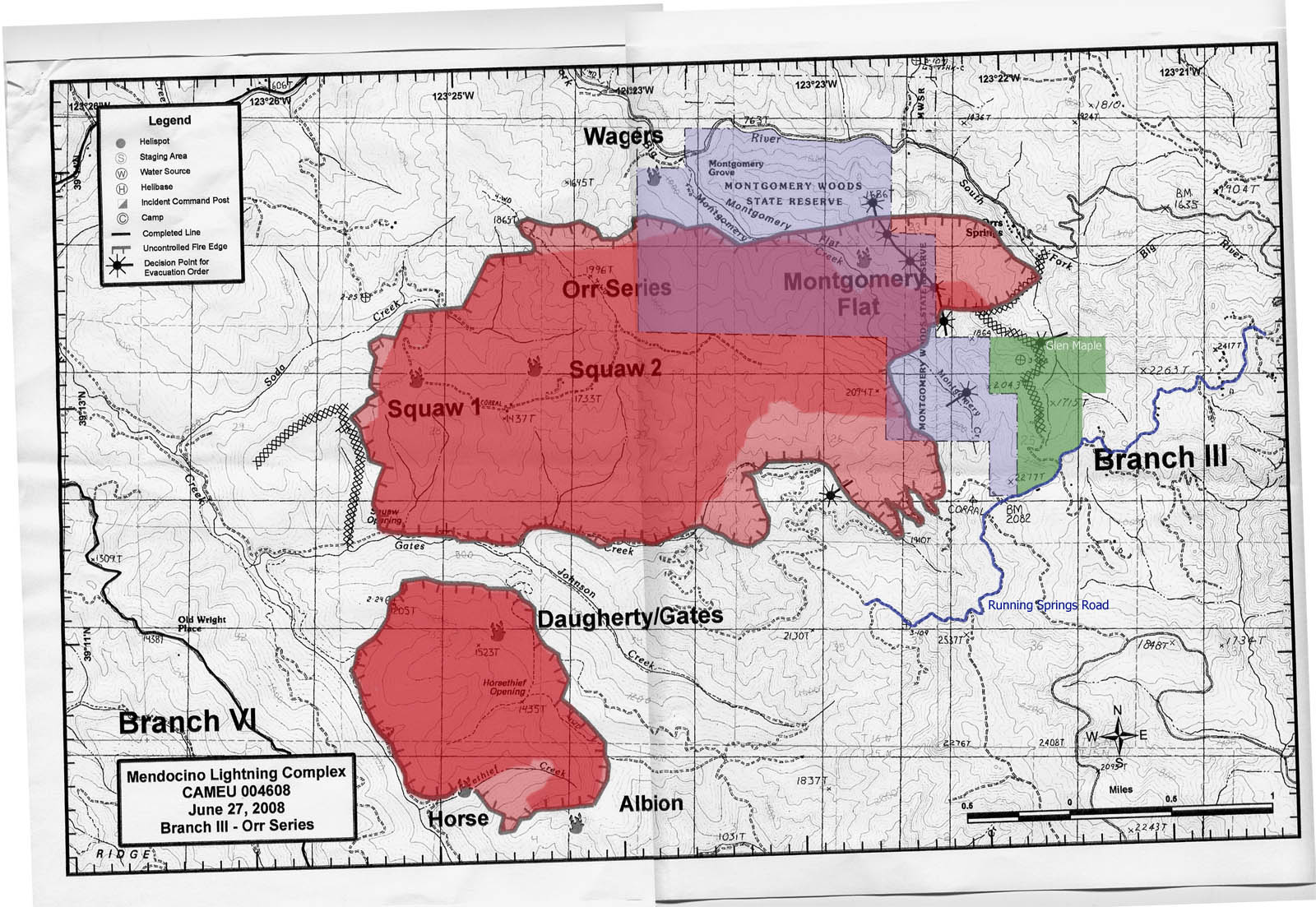
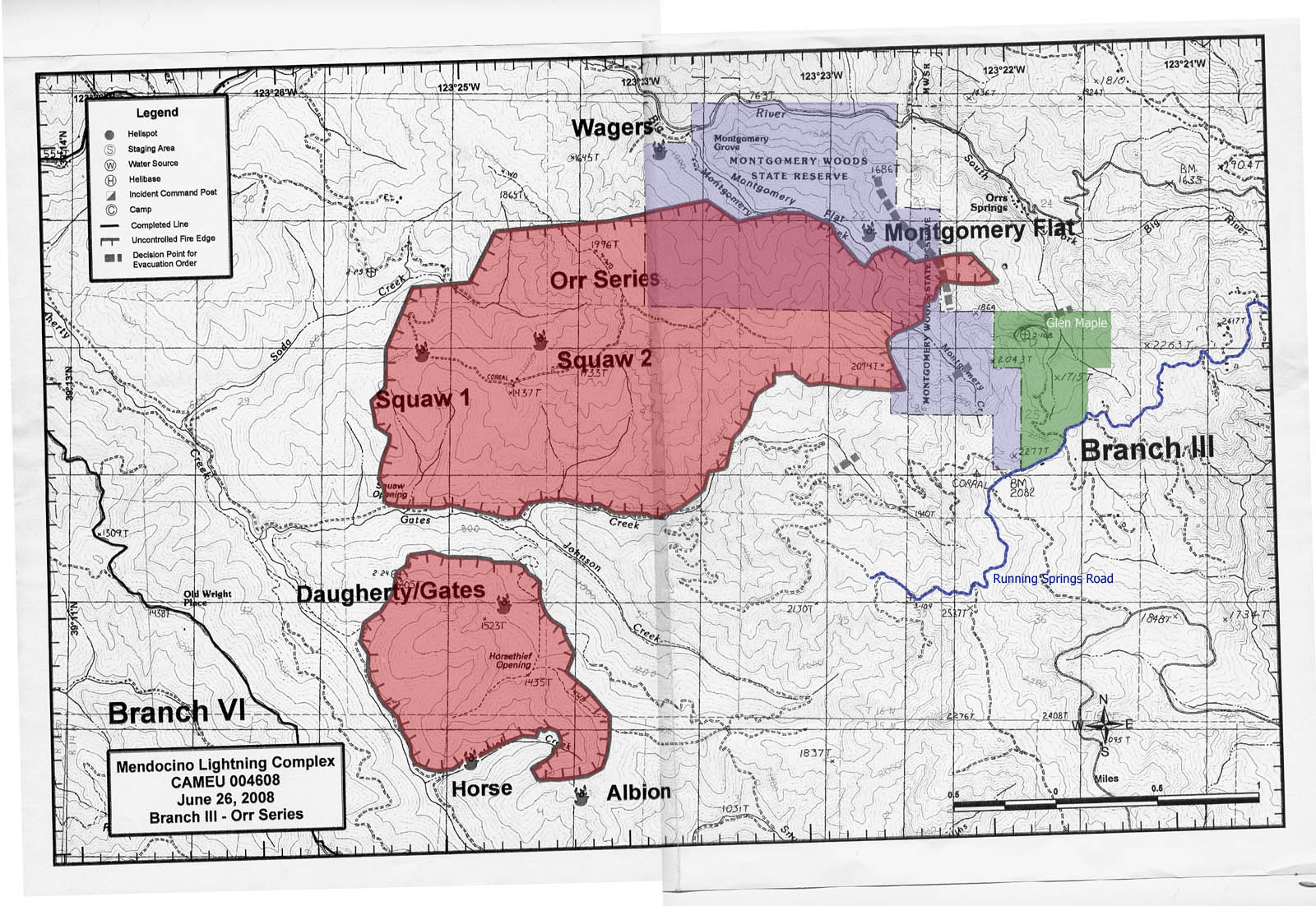
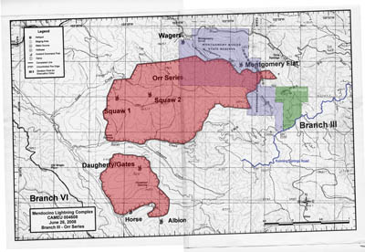
Orr Series-Montgomery Woods and Horse-Daugherty/Gates Fire Maps
This fire started West of Montgomery Woods and then came across the woods to
Running Springs Ranch on the East. Montgomery Woods is shaded in blue,
and our place is shaded in green (all borders are approximate; most recent maps first).
Click on the images to see a larger version.
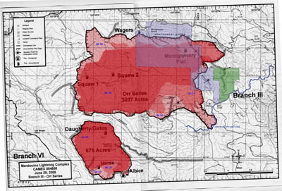
7/2/2008 fire (7/2 area is lightest).
The fire has changed shape, but has not grown.
We had incursions at the NorthWest and along the East and in the back part of
Running Springs Ranch Road (although much of that was a back-burn).
On our property (Glen Maple), the part up to the firebreak (X's) and
Montgomery Woods is now black, thanks to the burn. Now that the fire is
smaller (YAAAY!), it is a little trickier to understand the map.
The current boundary of the fire is the heavy black line
with tick marks on the inside border.
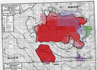
6/29/2008 fire (6/29 area is lightest).
The XX's mark fire breaks. You can see all the hard work they have been doing
putting in fire breaks, and most of them are holding.
The fire is still growing dangerously, but more slowly.
6/27/2008 fire (6/25 area is the darker shade -- new fire is lighter).
The XX's mark fire breaks. There is one to the West of the fire and
one from our place North to Orr Springs Road.
You can see how the fire came up to the break and then stopped.
The first good news since the lightning strikes!
Even in the places where it crossed briefly, it has burned itself out now.
6/25/2008 fire (shaded red)
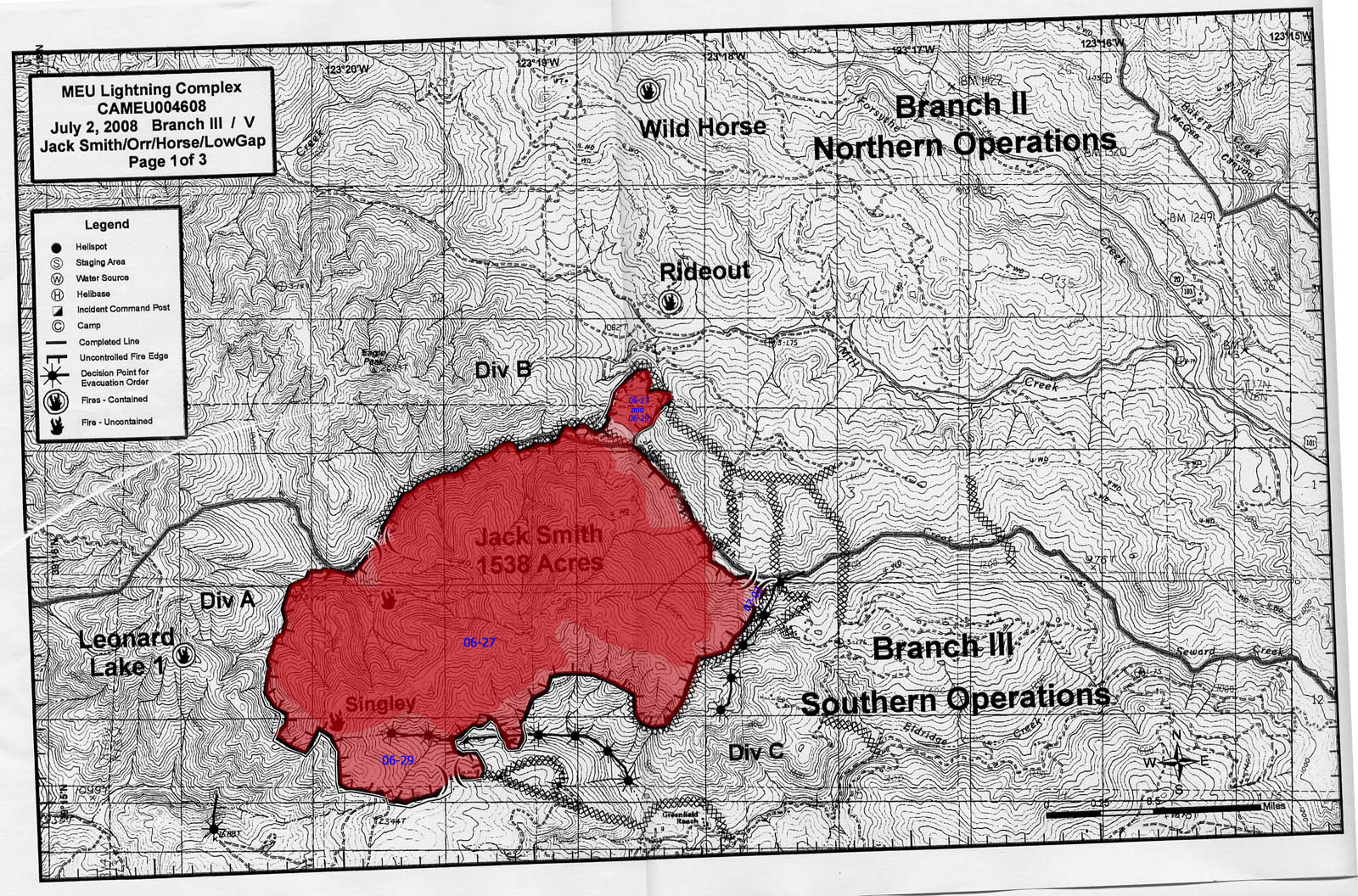
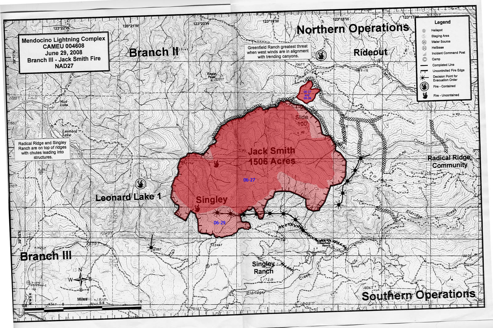
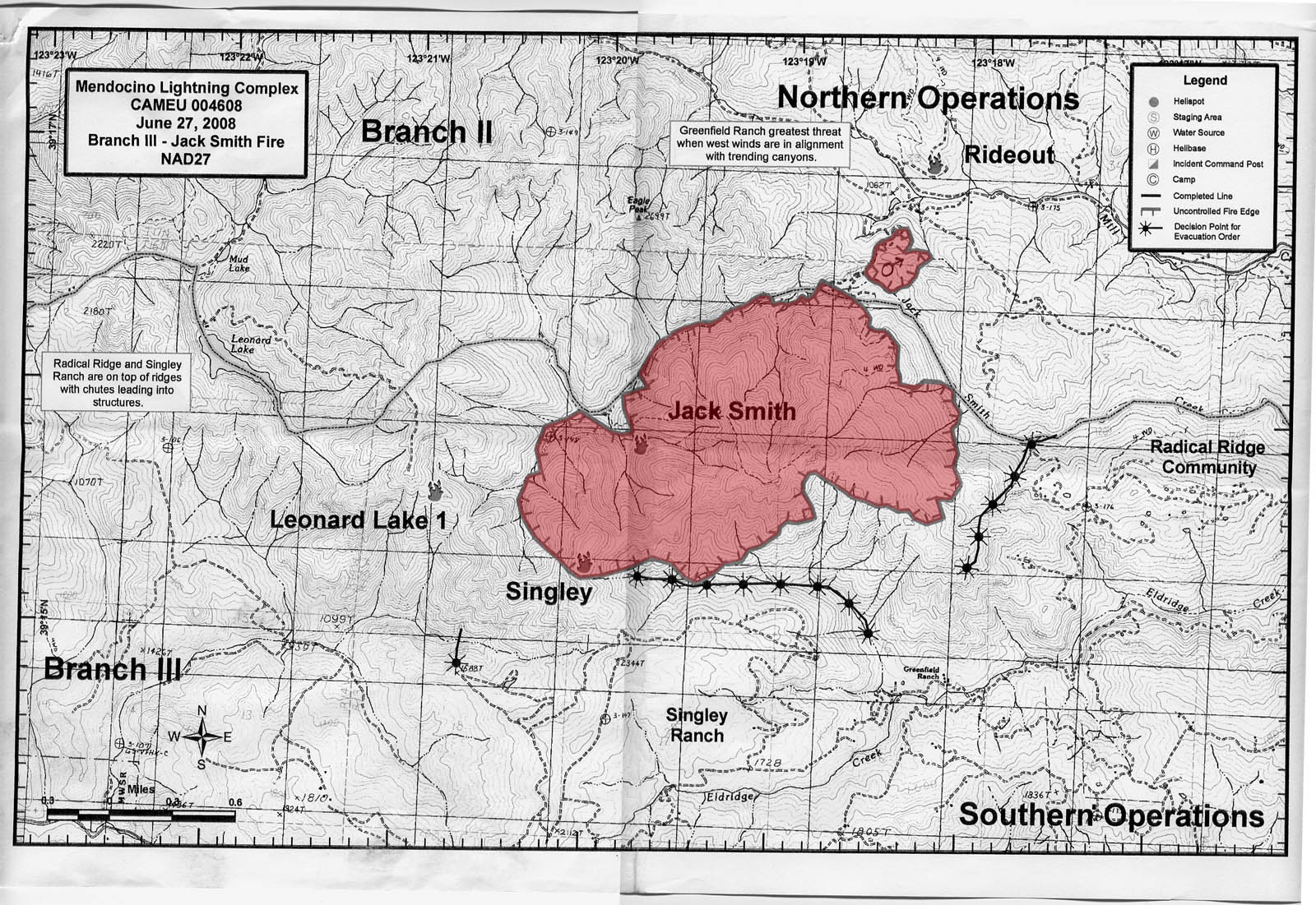
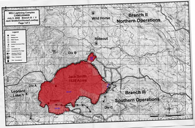
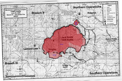
Jack Smith-Singley/Greenfield Ranch Fire Map
This fire is to the East of Running Springs Road.
Click on the images to see a larger version.
7/2/2008 fire (6/27 is shaded darkest, new 7/2 area is lightest)
6/29/2008 fire (6/27 is shaded darker, new 6/29 area is lighter)
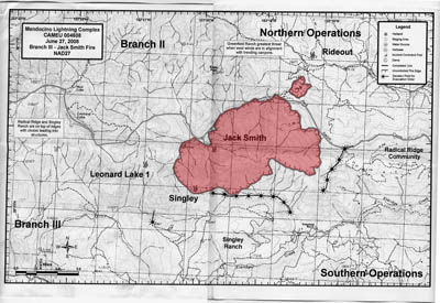
6/27/2008 fire (shaded red)
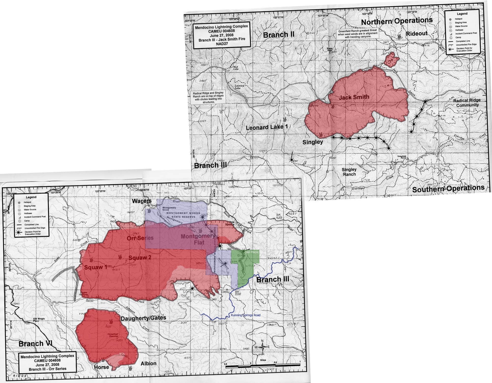
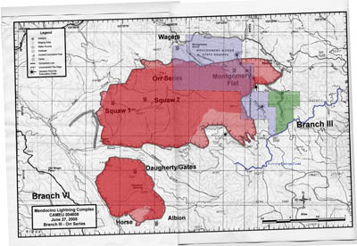
Orr-Series and Jack Smith fire maps hooked up (6/27/2008)
Several people asked how the maps hooked together.
Here they are, overlapped correctly at their shared corner.
Click on the images to see a larger version.
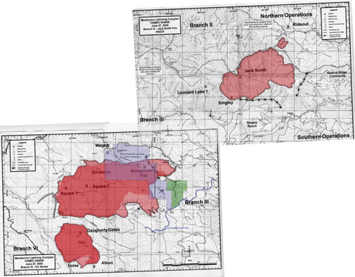
6/27/2008 fire (shaded red)